Category: Off The Beaten Path

Lone Mountain Hike in northwest part of Las Vegas

March 8, 2015

GPS: N36°14’17.88″ / W115°18’59.026″

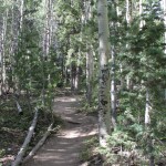
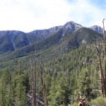
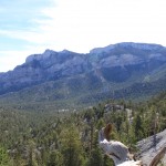
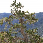
Lone Mountain is a steep, isolated, rocky crag located in the northwest part of Las Vegas just inside the Interstate-215 Beltway. The summit stands some 600 feet above the surrounding desert and homes, giving great views of the city and the surrounding mountains.

To get there take the 215 Beltway to West Lone Mountain Road, park at the newly built Lone Mountain Regional Park, there is parking and restrooms at the park. Another alternative route is to park at the end of Vegas Vista Trail  off of West Alexander Road and head up the western side for a more direct route.

Lone Mountain Summit, Las Vegas Nevada

Panoramic view of Lone Mountain Summit, Las Vegas Nevada

Click Here for a 360° Virtual View

There are several routes up Lone Mountain. The Northwest Route is fairly steep, but it is short (0.51 miles) and takes only about 30 minutes if you stop to enjoy the scenery along the way. The other is a longer from the north end. Lone Mountain is good place for a quick get-away or after-work hike. Be careful hiking this during the summer heat it can be very hot. This hike would make a good sunset/sunrise climb with a great view of the Las Vegas valley.

Elevation: 3342 ft.
Photo By: LasVegas360.com

Posted by: Vegas Info      catagory Hiking, Locals, Off The Beaten Path comments Leave a comment

Desert Megaphone

February 16, 2015

GPS: N35° 01′ 18″ W116° 11′ 51″ (WGS 84)

Desert megaphone

Desert Megaphone

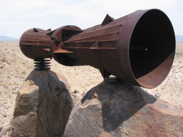
Desert Megaphone. This odd looking hunk of metal was found during a trip to Afton Canyon, California. on December 23, 2000. No one really knows who built this contraption or how they built it. This thing is huge. It must be about 10 ft. long and about 2 ft. round. It is made of heavy steel and has been welded into place and set into the rocks by drilling holes. This desert art work has been named the ‘Desert Megaphone’ and is a great thing to talk about.

Its located by Crucero Rd in the Mojave desert. Nobody knows who built the Desert Megaphone or who put it there, but I feel it was made by someone working for the railroad long ago. Some have speculated that the ends may have been covered with skins and used as a drum.

The Megaphone is a big tube of welded steel fashioned from several train parts. From the looks of it some attention to detail was done to create it. If you bang on it with a rock it makes a loud clanging noise. Someone also attached a small brass bell to it, for what reason who knows. The direction it points also has no reason either.

Leave a comment if you have any information regarding the “Desert Megaphone” or have seen it prior to December of 2000.

Posted by: Webmaster      catagory Off The Beaten Path, Way Off the Beaten Path comments Leave a comment

Bristlecone Trail Hike – Lee Canyon, Nevada

September 29, 2014

Bristlecone TrailGPS: N36° 18′ 23.8386″  – W115° 40′ 41.4588″ (WGS 84)

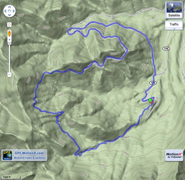
The Bristlecone Trail starting point is know as the Upper Bristlecone Trail. It is located a the very end of the Lee Canyon Road (Highway 156). Take US 95 toward Reno, pass the Mountain Charleston turn-off continuing straight for 10 miles, make a left on Lee Canyon Road (Highway 156), follow it until it ends. It trailhead starts in the parking lot of the Las Vegas Ski & Snowboard Resort, where the turnaround or helicopter landing pad is located. This hike will take you 2-3 hours to complete, depending on stops and breaks. The trail is clearly marked and you will notice a fence on either side of the trail for the first quarter of a mile. This was installed to protect some sensitive plants for butterflies.  The first part of the trail is lined with Ponderosa Pine, Aspens, and further near the summit are the Bristlecone Pines. The hike offers great views of Lee Canyon and the surrounding area. Even with 105°+ temperatures in Las Vegas the mountain offer a cool escape from the dreaded heat.

Warnings: This hike starts out at 8,600 feet and reaches an altitude of 9,381 feet.  So if you just came up from the valley desert floor, be prepared for some heaving breathing. Also, beware that there are mountain bikers on the trails, so watch out.  The dirt road portion of the hike (last 4 miles) is quite wide and has room for everyone and has a gentle slope.

The full loop back to the parking lot is just under 6 miles.  The hardest part is the first 2 miles. Once pass the summit, it is a gentle slope to the Lower Bristlecone Trailhead. A final small hike along the roadside for 1/2 mile will bring you back your starting place. This hike is not a difficult hike – just a little long and a lot of breathing for the first 2 miles. Have fun, bring water and be safe.

Update: This trail is great to hike anytime in the summer to get away from the scorching heat of the lower desert floor. But as a reminder, and if you time it right, try to hike it around September 21 and you may catch the Aspens in their golden and reddish Autumn colors before they are discarded to the forest floor.

Lee Canyon – Bristlecone Trail – Click for hi-res photo

View 360° Panoramic of the Bristlecone TrailHead

Base of Las Vegas Ski & Snow Resort – Summer

View 360° Panoramic of the Las Vegas Ski and Snow Resort

Photos by: LasVegas360.com

Posted by: Webmaster      catagory Hiking, Mt. Charleston, Off The Beaten Path comments Leave a comment

Carpenter 1 Fire Update Day 11 Hot Spot Map 7:15am

July 11, 2013
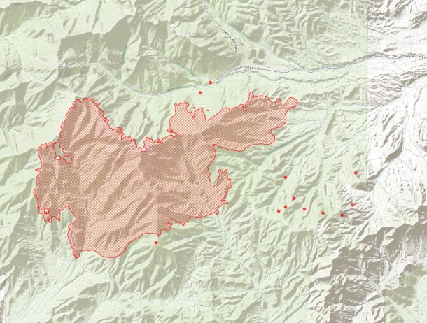
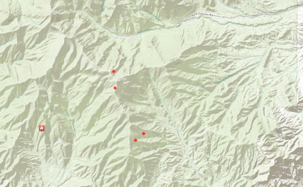
Hot Spot Map Carpenter Fire 1- Mt Charleston July 11 2013 7:15 am PST - Click to view Large Map

Hot Spot Map Carpenter Fire 1- Mt Charleston July 11 2013 7:15 am PST - Click to view Large Map

Here is the latest map. It looks less smokey upon the mountain this morning and there has been some rain come through. I hope it helps. Last Night, fire could be seen from the Las Vegas Valley as flames came over the ridge behind Red Rock Canyon.

Hot Spot Map Carpenter Fire 1- Mt Charleston July 11 2013 7:15 am PST - Click to view Large Map

Hot Spot Animation Carpenter Fire 1- Mt Charleston July 11 2013 7:15 am PST - Click to view animation

Posted by: Vegas Info      catagory Hiking, Mt. Charleston comments Leave a comment

Carpenter 1 Fire Update Day 10 Hot Spot Map 5:30pm

July 10, 2013
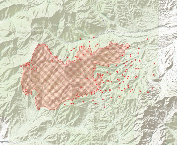
Carpenter 1 Fire Mt. Charleston 7/10/2013 5:00pm Click to View Larger Map

Carpenter 1 Fire Mt. Charleston 7/10/2013 5:00pm Click to View Larger Map

Posted by: Vegas Info      catagory Hiking, Mt. Charleston comments Leave a comment

Carpenter 1 Fire Update- Day 10- 25K+ Acres Burned 10:45 am

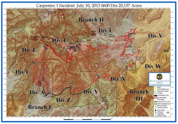
Carpenter 1 Fire New Map Released

Carpenter 1 Fire New Map Released - Click to View

Carpenter 1 Wildfire Update: Wednesday, July10, 2013 9:00 a.m.

Fire activity increased on Tuesday from southwest winds gusting up to 30 mph. The fire pushed northeast, through Harris Springs and Prospect Springs onto Bureau of Land Management property. An additional 5,767 acres burned, one commercial structure and five others were lost on the Prospect Ranch. The fire slopped north across Kyle Canyon Road around Mile Marker 6, east of Harris Springs Road. Dozers, engines and hand crews worked late into the night to stop the fire growth in this location. Overnight burnout operations on Tuesday brought a blackened line to the edge of the Rainbow Subdivision. On Tuesday, helicopters flew more than 43 hours and dropped 162,000 gallons of water on the fire. Four Single Engine Air Tankers (SEATS) each dropped two loads of retardant and the Very Large Air Tanker (VLAT) supported these operations.

Today’s Activity

Additionally, 274 firefighters joined the incident for Wednesday’s shift. Fire managers are expecting another active fire day, with weather conditions similar to Tuesday. Firefighters are working with dozers to build containment lines around the 3-400 acre slopover across Kyle Canyon Road. Large helicopters will support this operation with water and retardant drops. Hot Shot crews will work to strengthen the containment lines on the west side of the fire, above Lee Spring. On the north side of the fire, by Rainbow Subdivision, crews will continue to strengthen the fire edge near Cathedral Rock.

Strategic burnout operations will continue in Lovell Canyon, moving to the northeast. The fire has burned into lighter fuels and flatter terrain on this eastern side, and fire managers are optimistic about containing this fire edge and further securing the Prospect and Harris Ranch areas.

Current Situation

Total Personnel 1,077
Size 25,524 acres
Percent Contained 10%
Fuels Involved Pinyon Juniper
Fire Behavior Running fire behavior with short crown runs. Group tree torching and spotting.
Significant Events The Great Basin Incident Management Team #2 assumed command of the Carpenter 1 Fire at 0600 on Sunday, July 7.
Posted by: Vegas Info      catagory Hiking, Mt. Charleston comments Leave a comment