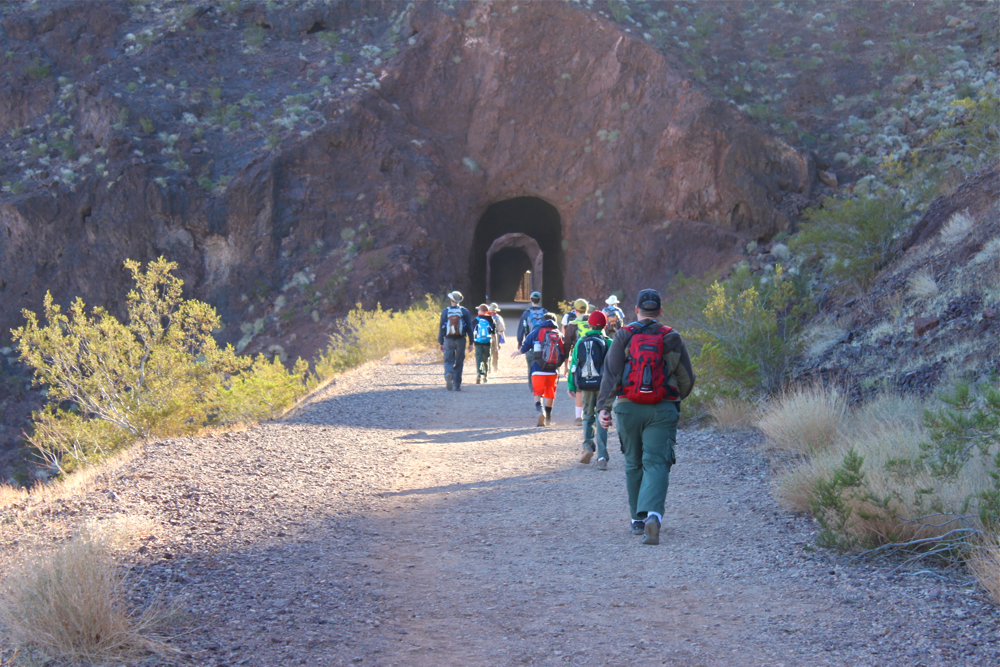
5 Tunnels Hike to Hoover Dam
GPS 36.011096º N – 114.794076º W
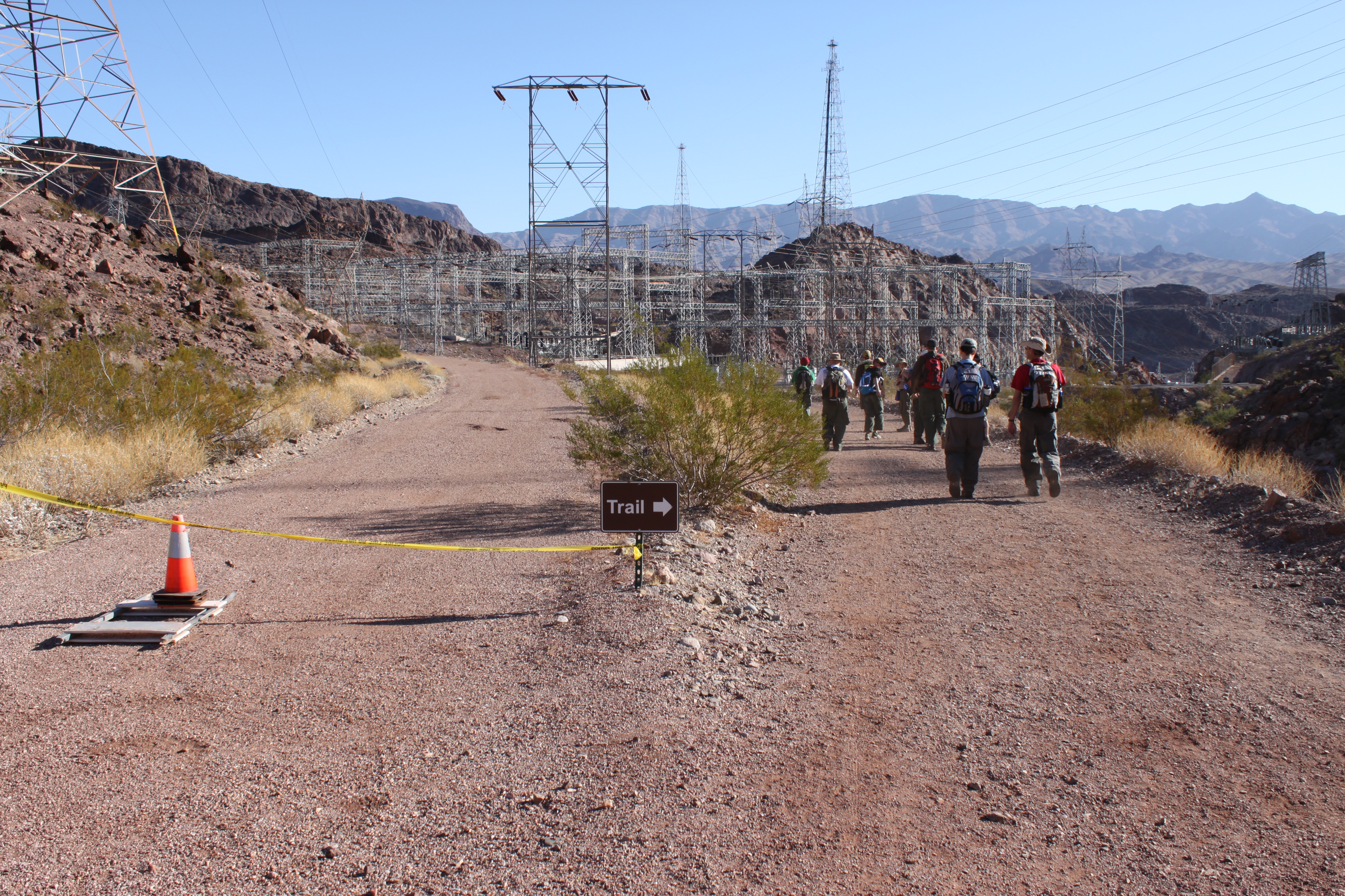
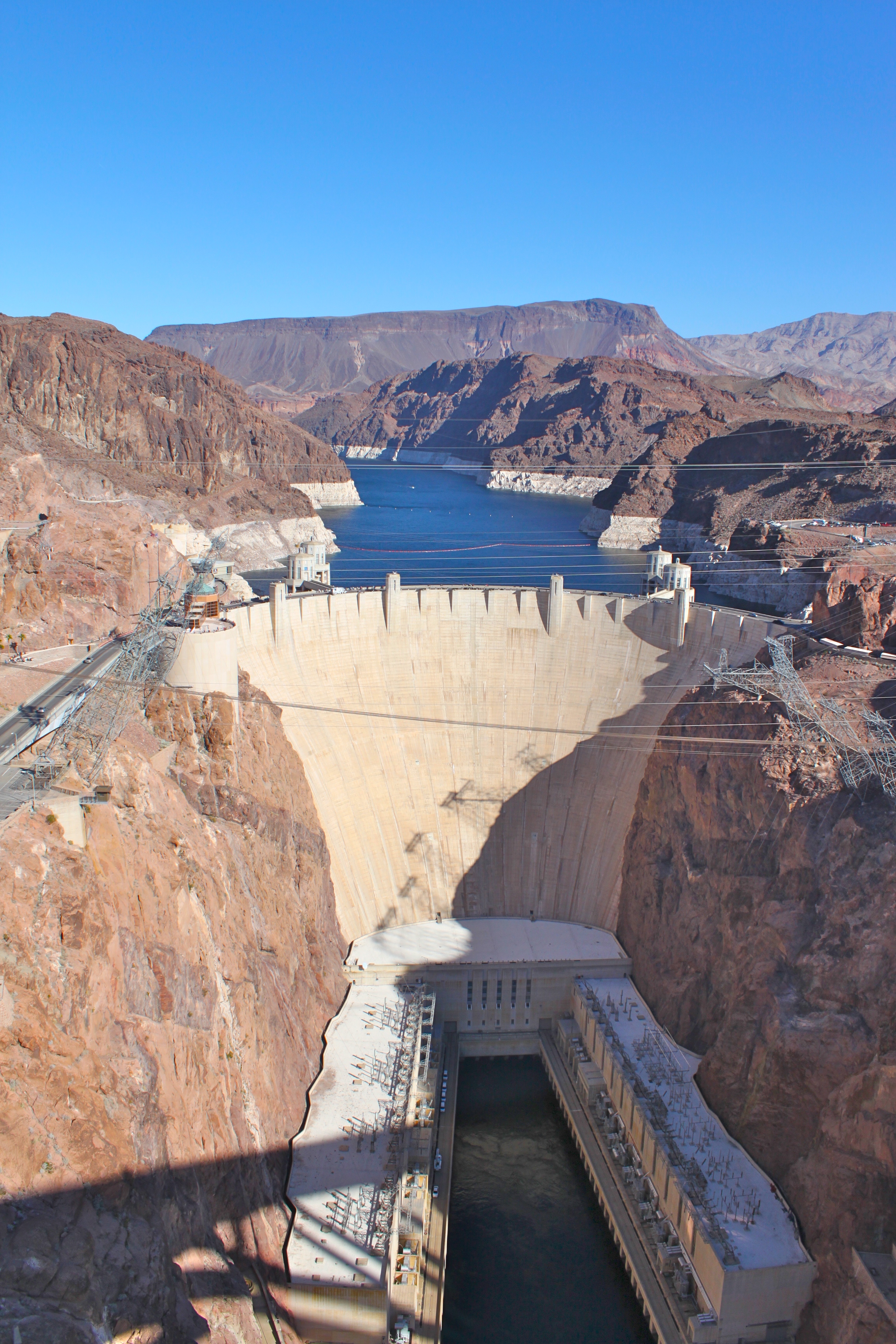
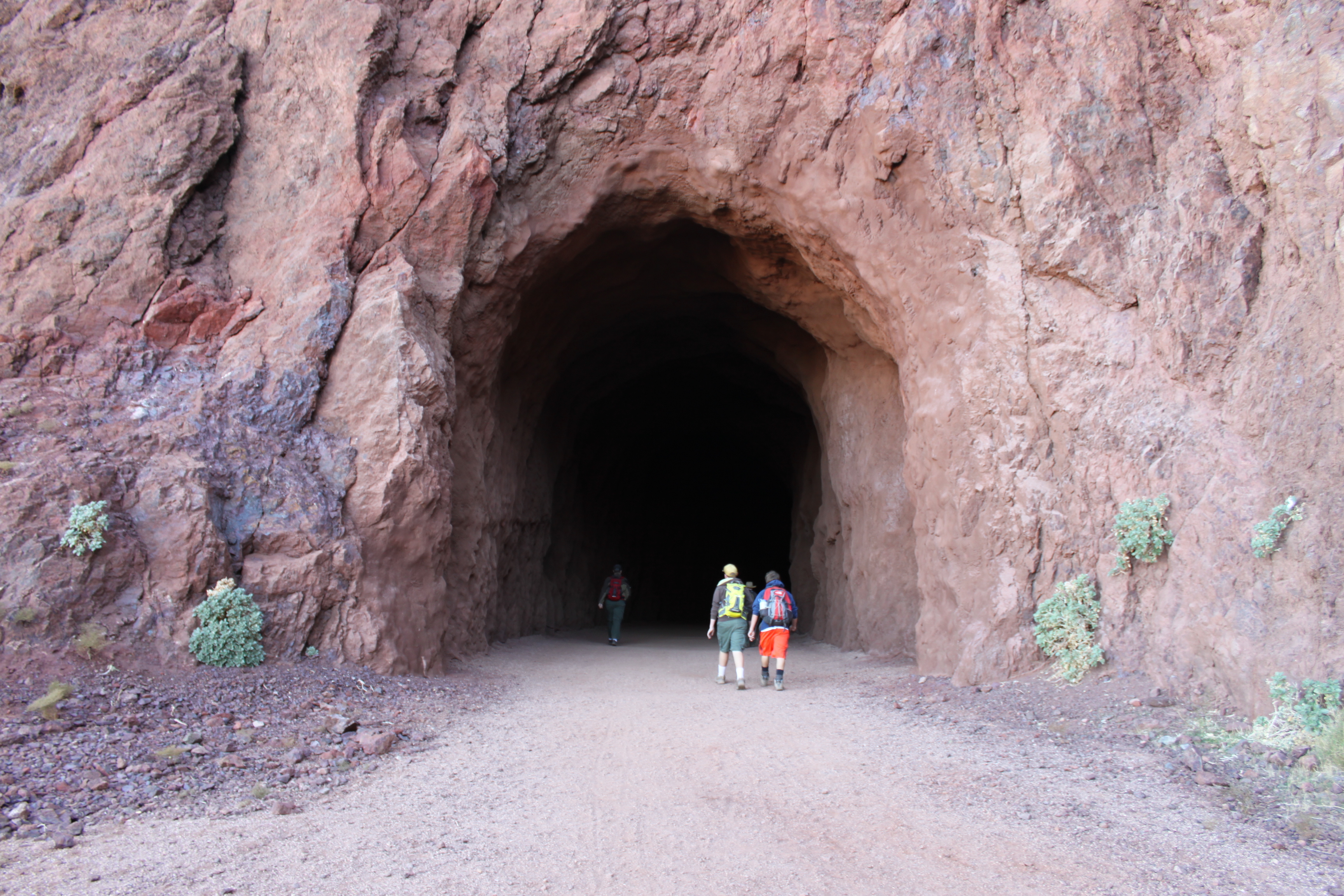
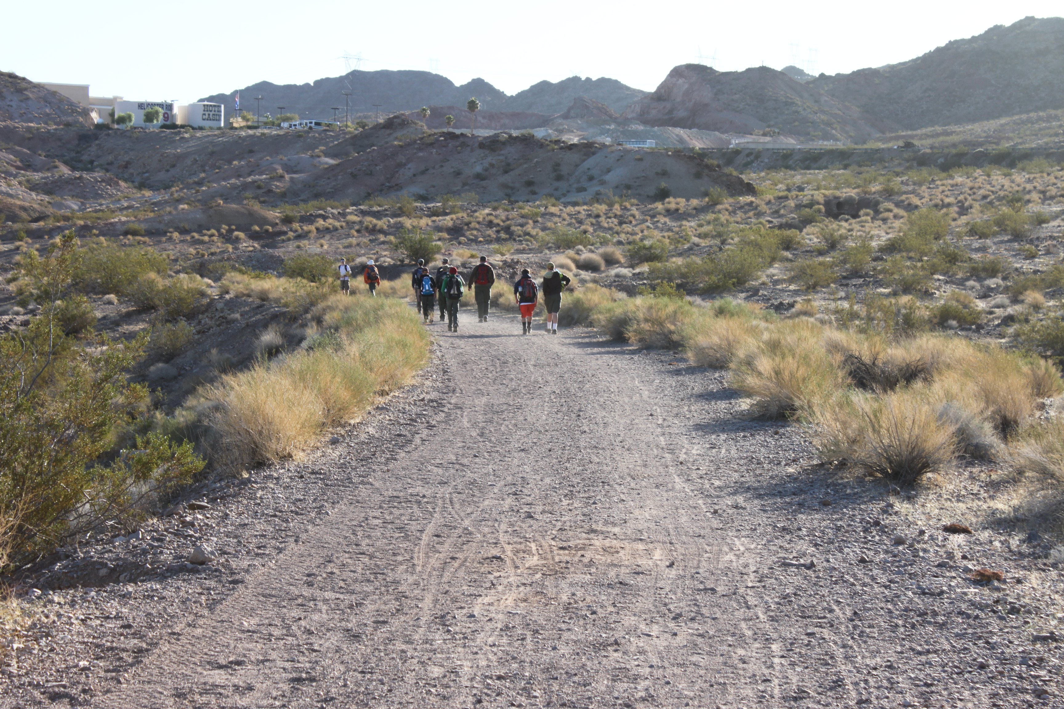
The 5 Tunnels or the Historic Railroad hike to Hoover Dam is on the old historic railroad that was used to build Hoover Damn in the ’30. The trail has been removed of all the rail and ties it once had. The trail starts just off the US 93 (Great Basin Highway) on Lakeshore Road heading to Lake Mead from Boulder City. There is parking lot on the east side of the road. This trail to the dam take you through 5 larger size tunnels on the way to the dam. No flashlight are needed for this hike. The trail is a smooth gravel road and is very popular with runners, hikers and mountain bikers. It is about 3.8- 4 miles to the dam and you come out on the top level of the parking lot at the Hoover Dam visitor center. You can easily add a few more miles walking to the Arizona side of the dam and up to the largest concrete arched bridge in North America. On this hike we did both and the total distance was just over 10 miles round trip.
This is a good hike to do in cooler weather, summertime would be too hat as this part of Lake Mead tends to be about 10 degrees hotter that Las Vegas.

Trail map to Hoover Dam
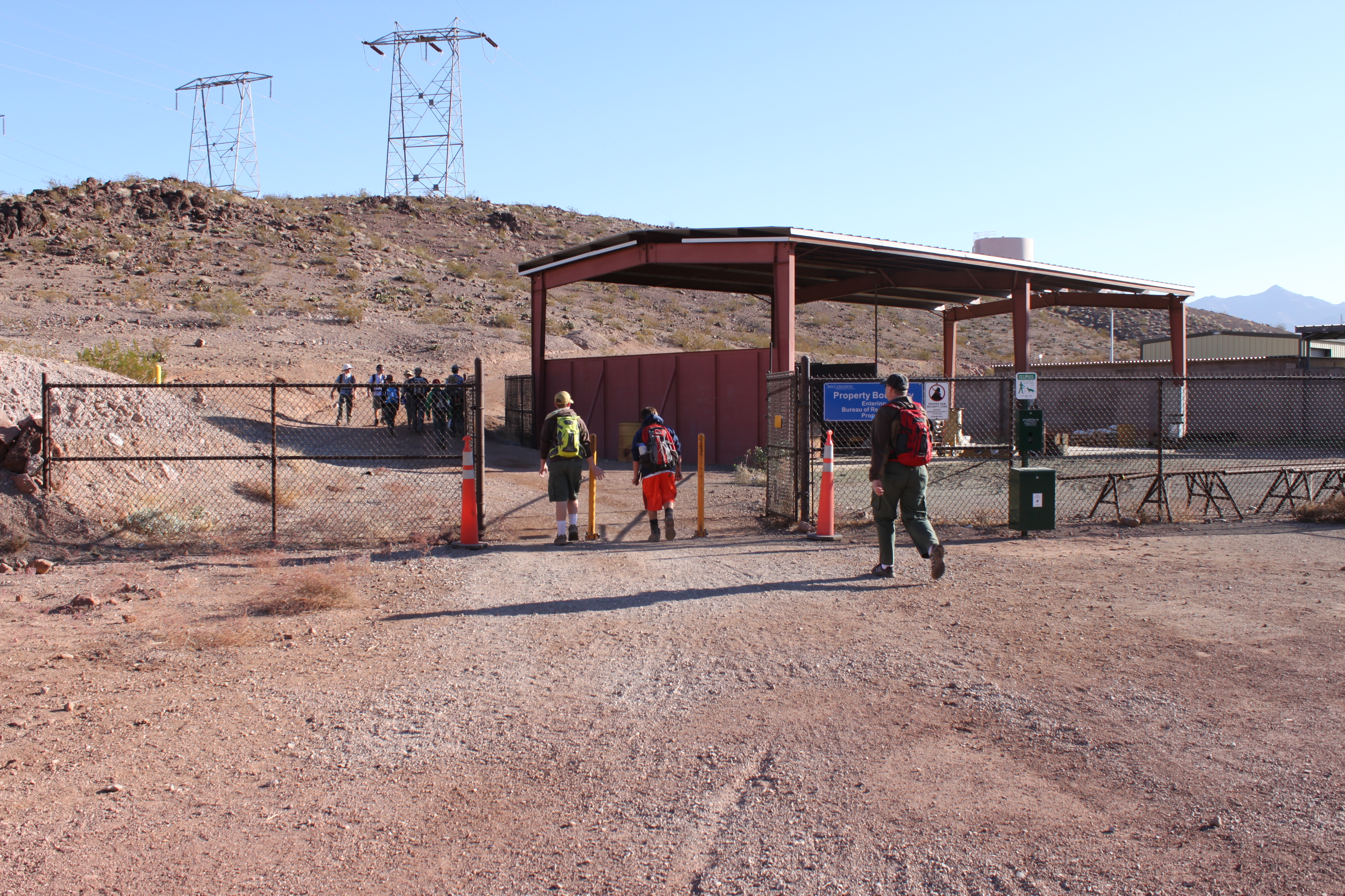
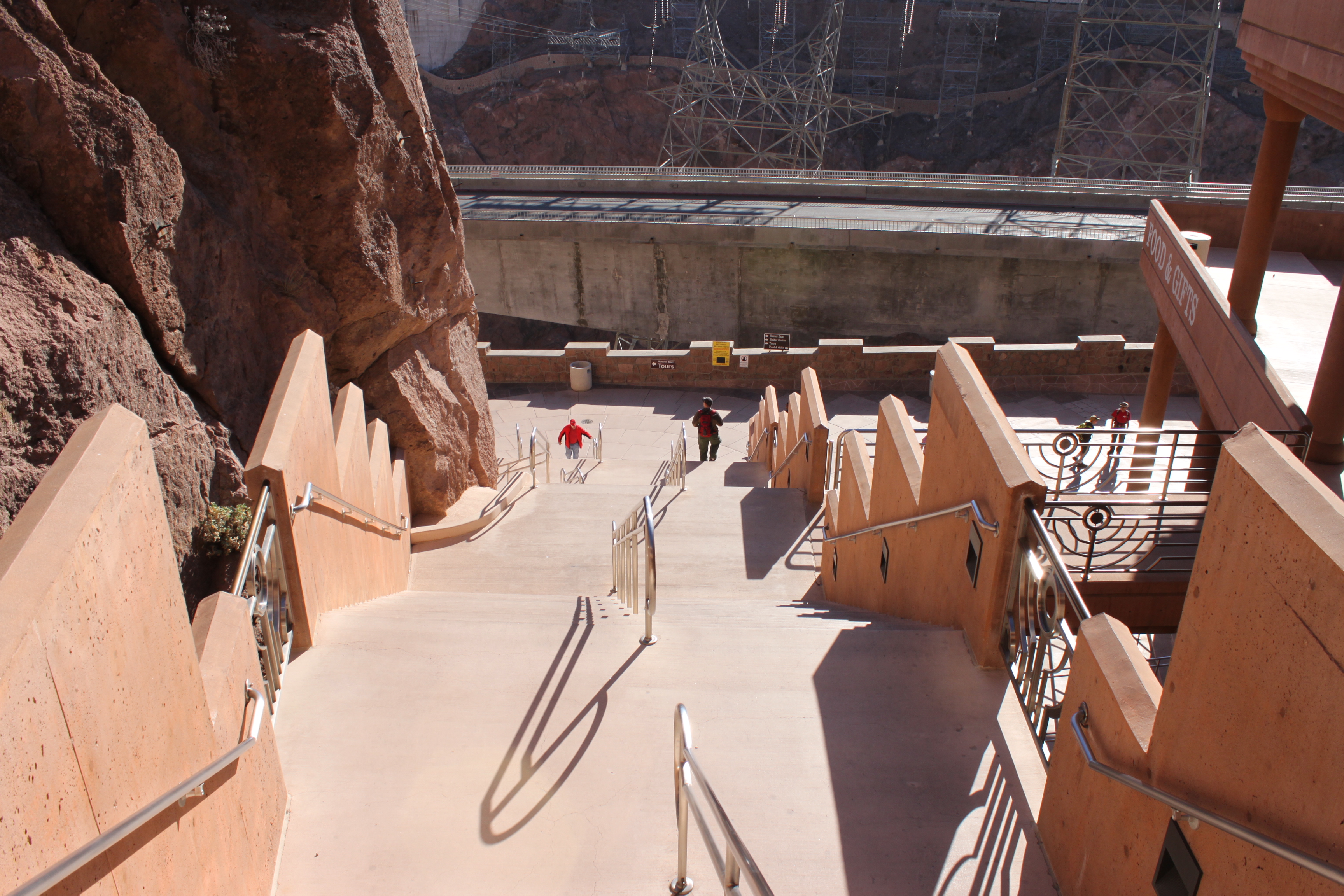
A note about the tunnels, although they vary in length, generally they measure 300 feet in length and are at least 25 feet wide and at least 30 high. The trail is very easy to hike and loses elevation as you make your way to the dam (about 300 feet). Along the trail you will see great views of Lake Mead. as you approach the dam follow the trail markers though some large gates as the trail changes from the main road to a clearly marked side trail. You will also travel through the Hoover Dam’s large electrical yard. At the end of the yard is a designated spot to pick-up hikers and it is free to get in here opposed to tying to pick them up at the parking garage which cost $7.

Panoramic view of Lake Mead from the trail
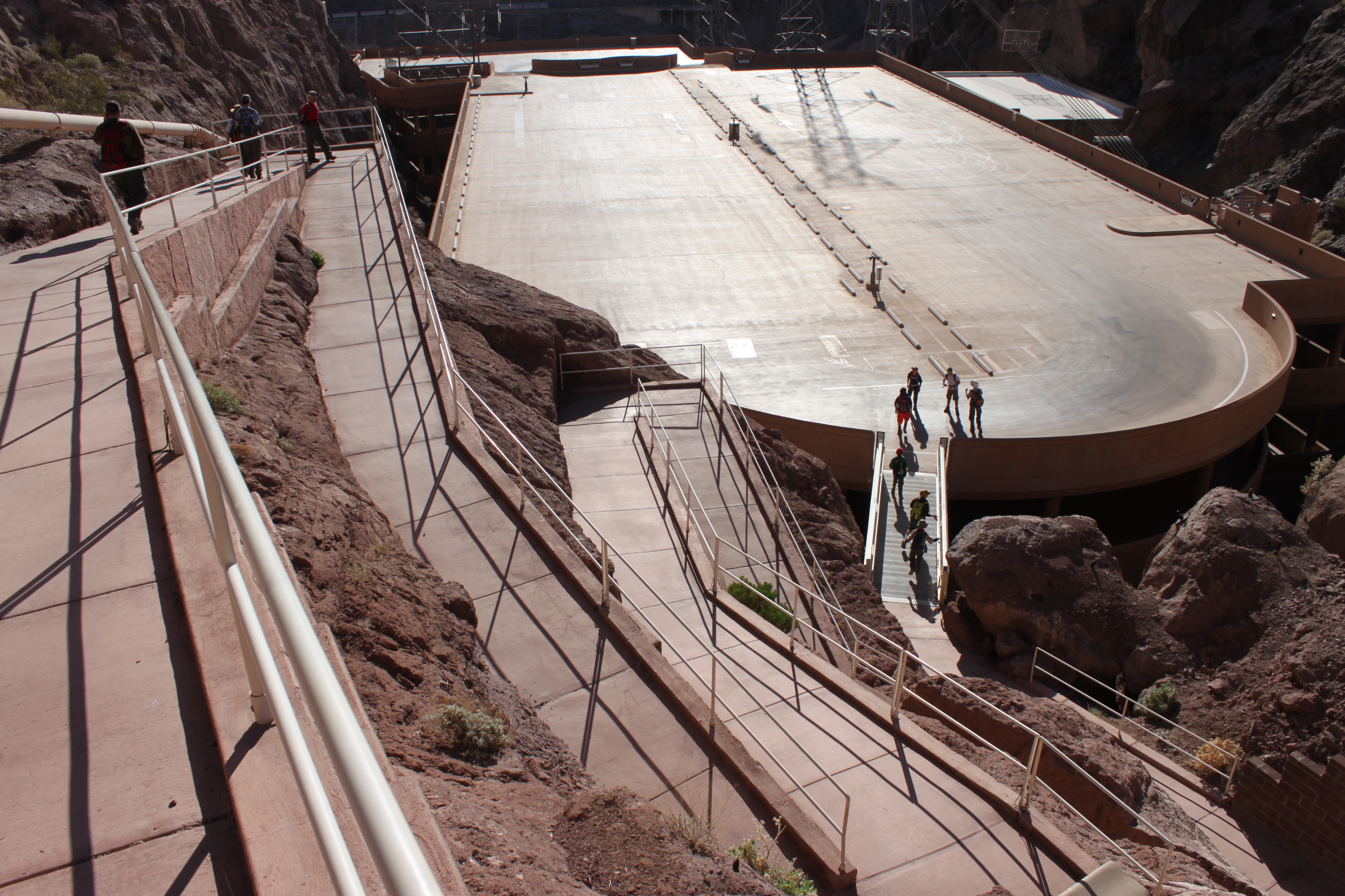
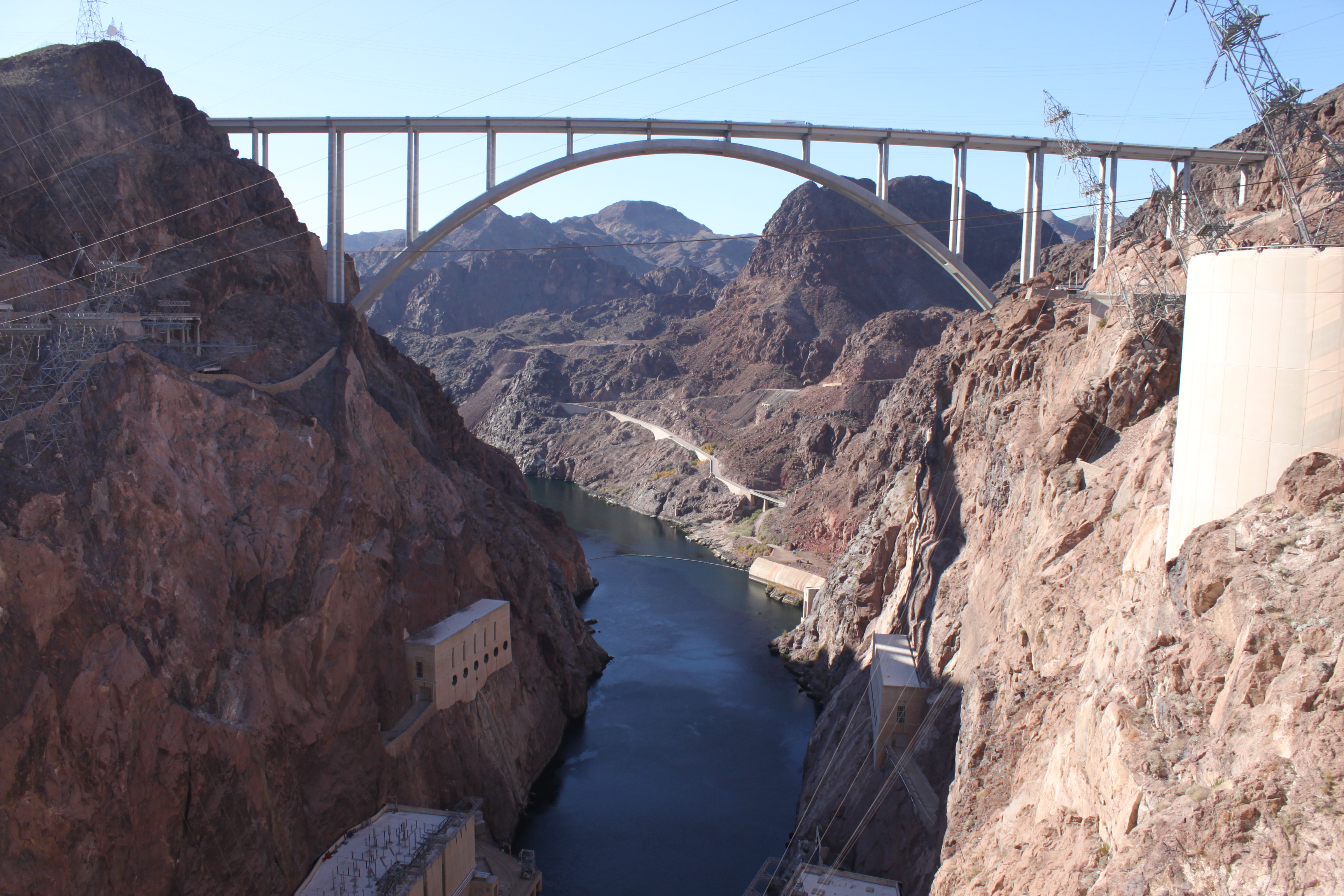
If you want to get up to the new Mike O’Callaghan – Pat Tillman Memorial Bridge, also commonly known as the Bypass Bridge, you will need to make a right in the middle of the electrical yard south to the main road. From there, you cross the old highway and make your way up the 7 flights of stairs, or use the long sweeping ramps to access the top of the bridge.
The Historic Railroad Tunnel is a great hike near Las Vegas with a fabulous ending at Hoover Dam. Bring a camera, and plenty of water, for this historic hike.
Photos by: LasVegas360.com
Like this:
Like Loading...
Webmaster