Tag Archives: Hiking

Raintree – Mummy Springs Hike (Mt. Charleston)

June 6, 2016
Raintree

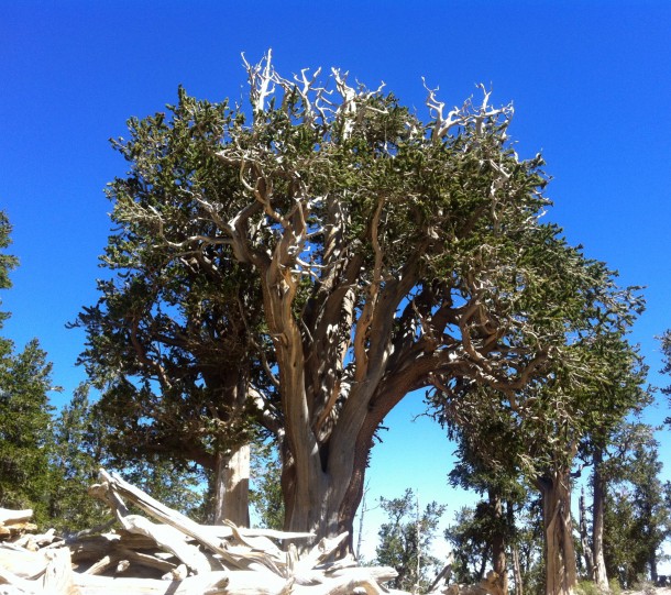
Raintree is a 3,000-year-old Bristlecone Pine Tree

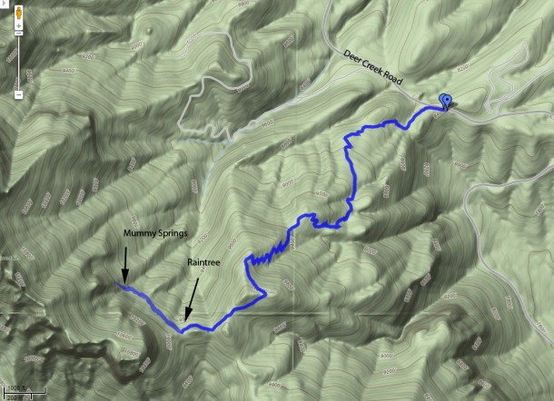
One of the Oldest living things in the State of Nevada is a 3,000 year+ Bristlecone Pine Tree called “Raintree”.  This 6 mile round trip hike  has about 1700 ft. elevation gain and altitudes over 10,000 ft. It takes about 3.5 hours. Once you make it to the “Raintree” it is about 1/3 mile to  Mummy Springs veering right on the trail.

The trailhead is located up in the Spring Mountains on Deer Creek Road between Kyle and Lee Canyons, about 1 hour northwest of Las Vegas.

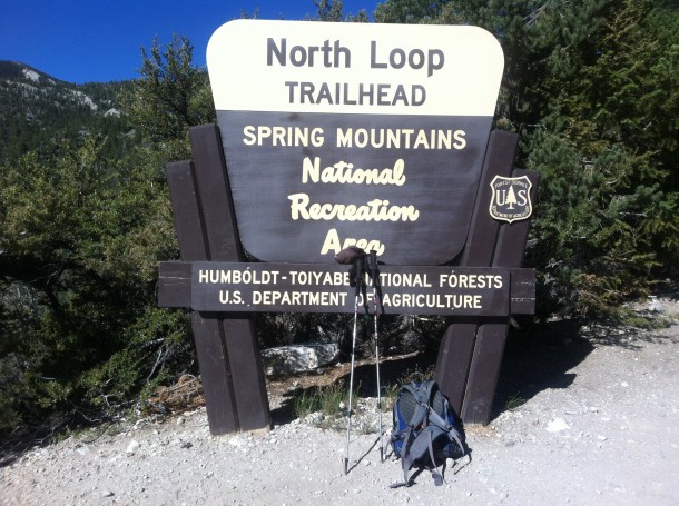
From town, drive north on Highway 95 to Highway 157 (Kyle Canyon Road). Turn left onto Highway 157 and drive west for 17.1 miles to Highway 158 (Deer Creek Road), which is just past the Mt. Charleston Hotel. Turn right onto Highway 158 and drive north for another 4.8 miles to the second turnout past Hilltop Campground. Watch for a paved parking area on the west (left) side of the road with a large sign. Trailhead starts here.

North Loop Trailhead for Raintree/ Mummy Springs

North Loop Trailhead for Raintree/ Mummy Springs

Raintree Mummy Springs

Raintree / Mummy Springs Hike in Mt. Charleston

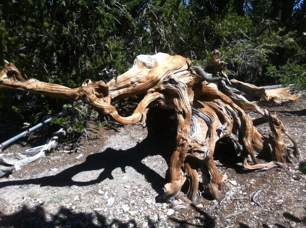
Tree that looks like an Elephant

Tree that looks like an Elephant on the trail

Please respect the Bristlecones, as well as the other trees and do NOT remove or deface them in anyway.

Photos by: Lasvegas360.com

Posted by: Vegas Info      catagory Hiking, Mt. Charleston, Off The Beaten Path comments 2 Comments

Lone Mountain Hike in northwest part of Las Vegas

March 8, 2015

GPS: N36°14’17.88″ / W115°18’59.026″

Lone Mountain is a steep, isolated, rocky crag located in the northwest part of Las Vegas just inside the Interstate-215 Beltway. The summit stands some 600 feet above the surrounding desert and homes, giving great views of the city and the surrounding mountains.

To get there take the 215 Beltway to West Lone Mountain Road, park at the newly built Lone Mountain Regional Park, there is parking and restrooms at the park. Another alternative route is to park at the end of Vegas Vista Trail  off of West Alexander Road and head up the western side for a more direct route.

Lone Mountain Summit, Las Vegas Nevada

Panoramic view of Lone Mountain Summit, Las Vegas Nevada

Click Here for a 360° Virtual View

There are several routes up Lone Mountain. The Northwest Route is fairly steep, but it is short (0.51 miles) and takes only about 30 minutes if you stop to enjoy the scenery along the way. The other is a longer from the north end. Lone Mountain is good place for a quick get-away or after-work hike. Be careful hiking this during the summer heat it can be very hot. This hike would make a good sunset/sunrise climb with a great view of the Las Vegas valley.

Elevation: 3342 ft.
Photo By: LasVegas360.com

Posted by: Vegas Info      catagory Hiking, Locals, Off The Beaten Path comments Leave a comment

White Rock Loop- Hiking in Red Rock Canyon

January 8, 2013

White Rock Loop Trail at Red Rock Canyon

Duration: 3-3.5 hrs

Length: 6.3 miles

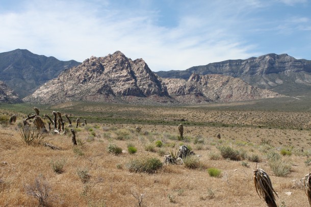
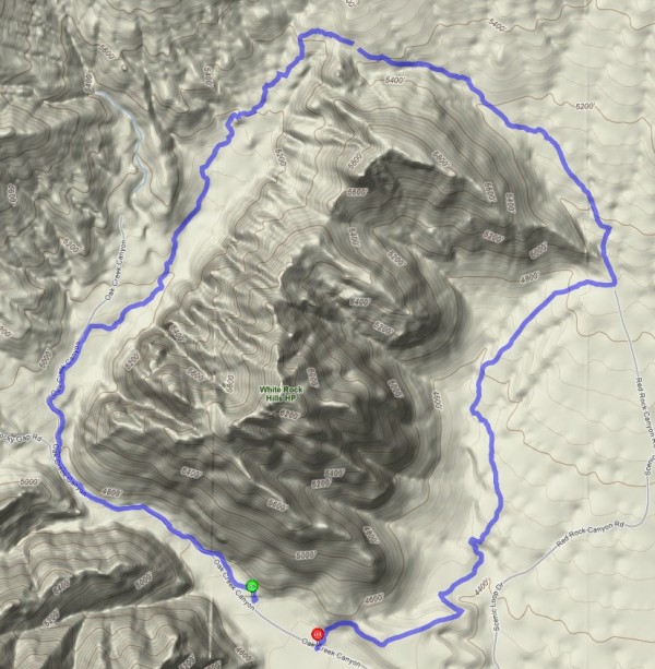
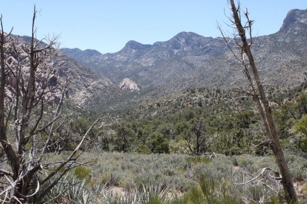
This 6.3 mile hike at Red Rock Canyon near Las Vegas, Nevada is a great fall/winter/spring hike. Located on the Red Rock Canyon Scenic Loop, the White Rock Loop trail is a great way to spend 3-4 hours. You will experience diverse terrain and plant life.  For much of the hike, you’re in the typical Mojave Desert surroundings.  When you get to the back side of White Rock Mountain, it’s like Red Rock Canyon’s hidden forest.  That side is wetter and there are a large number of pinyon pines, juniper trees, and desert plants such as yucca and cactus of various types.  It has a little of everything.

White Rock at Red Rock Canyon

White Rock Loop Trail

Up in the higher parts of the hike with the Pinion trees

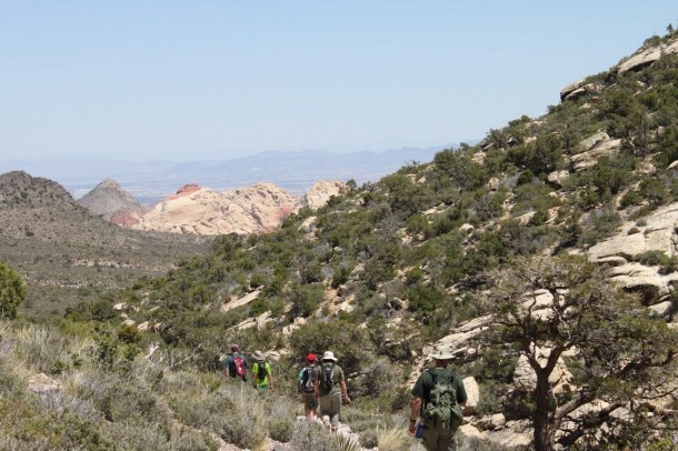
I recommend starting at the Willow Springs picnic grounds- there are restrooms and parking and heading uphill going clockwise around the mountain.  Once at the saddle, most of the hike is downhill from there. You will have about a 1000 ft. elevation change with this hike and expect 3-3.5 hours to complete the loop. I don’t recommend this hike during the hot summer hours, if you are going to hike during the summer, make it a early morning hike as for it can get quite hot on the return portion.

Wear sturdy shoes, bring water and a little food for this hike.

Coming down the backside with Las Vegas in the background

Directions: Take Charleston West to the entrance to the Red Rock Canyon National Conservation Area. Enter the through the fee area and follow the Red Rock Loop. The turn off (right-turn) is about 1/2 through the loop at the Willow Springs Picnic Area. Start your Hike there.

Happy hiking.

Photos by Lasvegas360.com


Posted by: Vegas Info      catagory Hiking, Off The Beaten Path, Red Rock comments Leave a comment

Valley of Fire

July 4, 2011

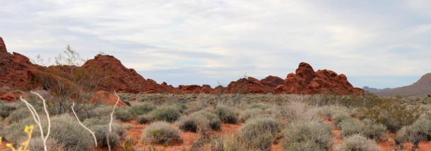
One of the most beautiful features of the desert are the brillant red rocks that are scattered throughout southern Nevada. These vivid hues can be best observed in the appropriately named, Valley of Fire.

Looking across the barren, hot, desert valley it is hard to believe that 600 milion years ago the entire area was under water. Animal and plant life was abundant here at that time and as the waters subsided over the next 400 million years the thriving ocean floor became a unique desert valley. The sandstone rocks vary in color from deep reds and purples to tans and whites and their unique formations have been formed by millions of years of erosion, wind and climatic change.

Some of the most interesting rock formations are the “Seven Sisters” which are seven unusal rock formations which stand in a row. They are remnants from the harsh erosion which has changed their shape over the years.

Ancient and Modern Man in the Valley of Fire

To look at this harsh desert landscape it is difficult to believe that ancient people once thrived here. Evidence of their lifestyle has been left behind in petroglyphic drawings. A few archaelogists believe that people lived here as long ago as 15,000 years although that assumption has been unproven most would agree that man was present here about 4,000 years ago. Small enclaves of families roamed and hunted in this area. Their main diet consisted of bighorn sheep and smaller game such as rabbits and tortoises. The first record of Europeans in the area was when the famous mountain man Jedediah Smith, who led the first party of fur trappers into the area in 1826. He was followed by Kit Carson in the 1840s. Just like a tale from an old western movie the Europeans and the Paiute people who had inhabited this area fought over the ownership of the land and its animals.

Mouse’s Tank

One of the greatest legends of the Valley of Fire is about a Paiute Indian named Mouse. Mouse was a known outlaw who worked on ferry that crossed the Colorado River. After a drunken episode where he shot up an Indian camp his employers fired him and dumped him off in Arizona. There, it is said, he killed two prospectors. A intensive search was conducted but Mouse could not be found. Apparently during these episodes Mouse would flee to the Valley of Fire to hide out. Here he would sometimes use “Mouse’s Tank”, a depression in the rocks that catches and holds rainwater for a time after storms. Mouse’s Tank is well hidden within the maze of rock formations on the Petroglyph Canyon floor, a perfect hideout for a fugitive. On July 11, 1897 a posse tracked Mouse near Muddy Spring and ordered him to surrender. Mouse would not give up and after a gun fight with the law Mouse was shot and killed.
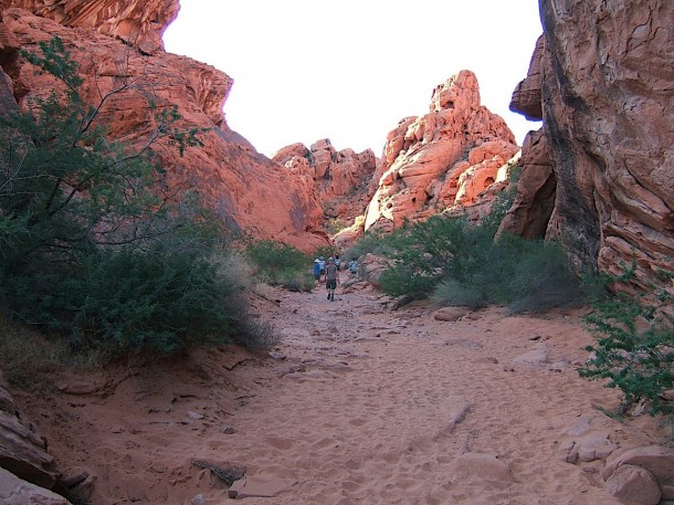
On the trail to Mouse’s Tank

Valley of Fire located 55 miles from Las Vegas it spans more than 37,000 acres. Nevada’s first state park, composed of stunning red sandstone formations and a wealth of Indian artifacts and petroglyphs. A vistors’ center provides information on the park’s history and geology. The Lost City Museum is located nearby. Valley of Fire Vistor Center: (702) 397-2088.

Posted by: Webmaster      catagory Off The Beaten Path, Valley of Fire comments Leave a comment

Red Rock Canyon

Click for Hi-Res 360: Red Rock Canyon

Click to view hi-res photo 360: Red Rock Canyon

Red Rock National Conservation Area

To observe the true beauty of the high desert you should make the trip to Red Rock National Conservation Area. Head west on Charleston Boulevard about 16 miles from Las Vegas. The Bureau of Land Management operates a visitors’ center where they exhibit plant, animal and desert life. Don’t miss the drive around the 13 mile scenic loop (toll booth payment required) as it winds through the colorful red rocks, Joshua trees and the unusually beautiful desert scenery.

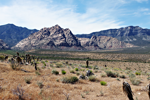
White Rock in Red Rock Canyon

White Rock in Red Rock Canyon

White Rock in Red Rock National Conservation Area. This is a good hike to do on cooler days. View White Rock Loop Hike

Photos by: LasVegas360.com

Posted by: Webmaster      catagory Hiking, Off The Beaten Path, Red Rock comments Leave a comment